One benefit of high-revisit satellites is their ability to re-image the same location daily or weekly. In this example, we use temporal satellite observations (2016 to 2020) to track drought impact, using PlanetScope imagery to confirm the change.
Working with Scion’s Geomatics team, Indufor has extended the science and developed a monitoring approach that can be used to link satellite imagery with environmental surfaces. The particular method illustrated correlates long-term rainfall trends with satellite imagery to extract key breakpoints or thresholds that flag sustained changes in canopy cover. The monitoring system generates an ‘alert’ where canopy deterioration exceeds a pre-determined benchmark.
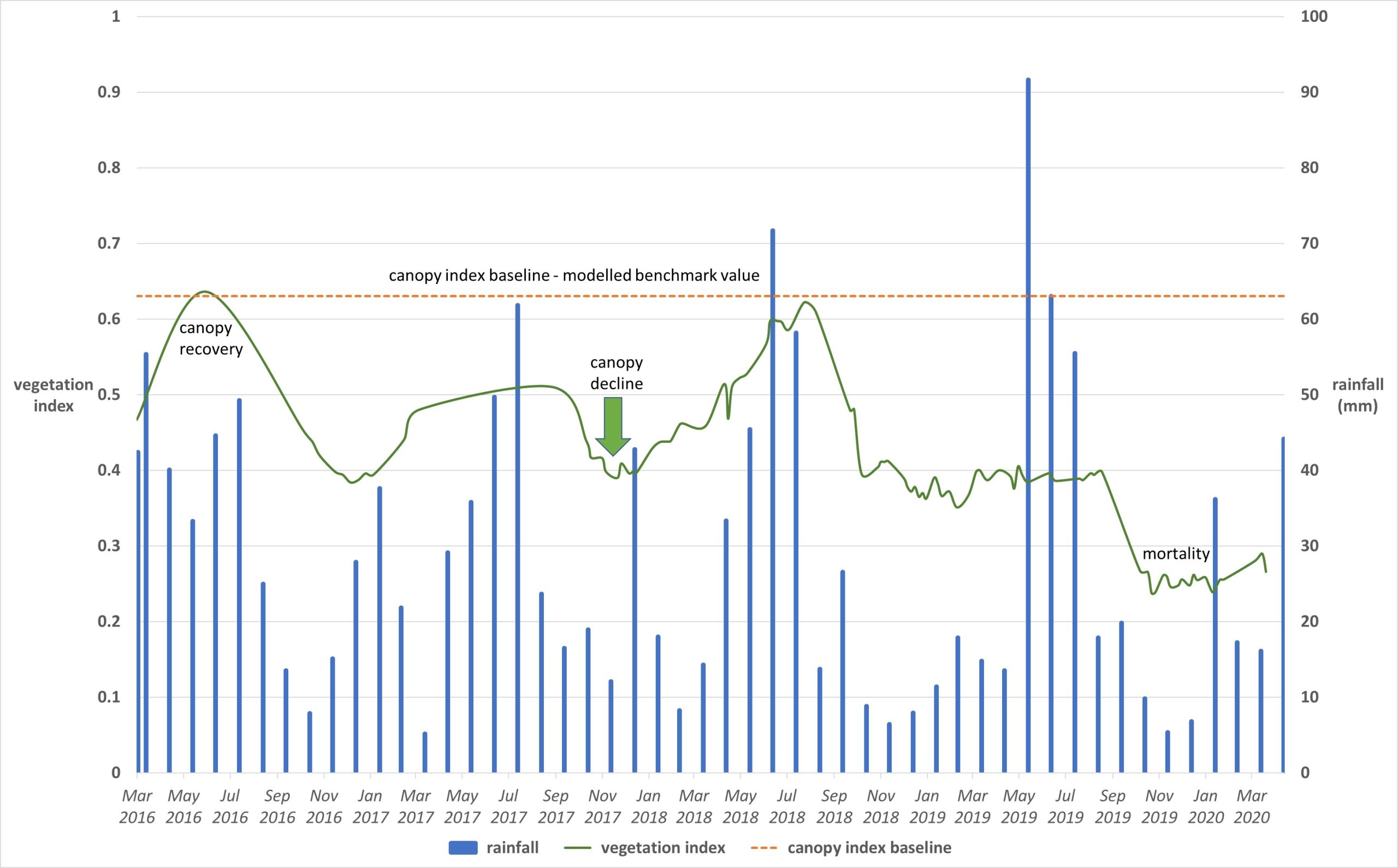
By way of illustration, this graph plots the vegetation index (green line) and rainfall records (blue bars) over a four-year period, across a single stand. The inclusion of rainfall data assists in explaining the temporal patterns and highlights the corelation between the satellite-derived vegetation index and monthly rainfall. For reference, the dotted line shows Indufor’s Canopy Index baseline, which for this particular stand helps to highlight the difference between the expected and actual canopy condition value.

Harnessing Rainfall &Satellite Image Time Series Information

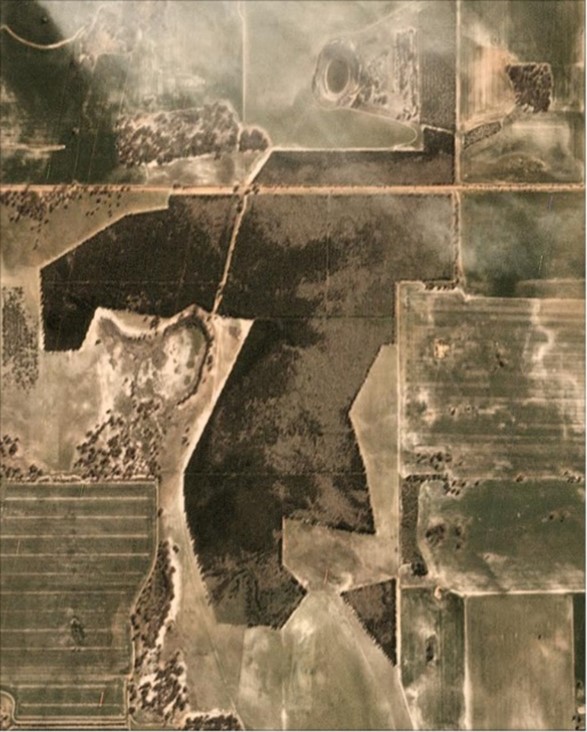
Confirming ‘Change Alerts’ using PlanetScope Imagery. Image Courtesy of Planet Labs Inc.
Such an approach demonstrates the benefits of using temporal information from satellite imagery and environmental data as a screening tool. In the past, such areas may remain unnoticed unless re-mapped or visited. The appeal of the method demonstrated is that it provides a scalable monitoring solution. As alerts are created, they are synchronised to mapping dashboards using a process that provides an efficient way of sharing information across an organisation.
Should the alert prove to be valid, a logical extension is the use of high-resolution imagery such as Planet’s, PlanetScope imagery to confirm and map the change.
The image swipe shows the PlanetScope (August 2020) as a base from which an automated boundary mapping has been created using Indufor’s area mapping algorithm.
At a broad scale detection of potential issues using environmental surfaces or meteorological records can be used to refine the search radius over which satellite imagery needs to be acquired for closer inspection. This approach has considerable potential for detection of diseases resulting in canopy defoliation. In collaboration with Scion, further improvements to the system are planned to evaluate how predictive models of disease, based on environmental surfaces, can be integrated into the existing system which uses satellite imagery to detect and map the impact of defoliation.
