Resource Monitoring Blog
Tracking Small-scale Riparian Afforestation Outcomes
In recent years an increasing focus has been placed on land restoration projects that seek to improve the management of riparian zones. These techniques include the selection of species, often native, to reduce sediment and nutrient runoff, improve streambank...
Building Forest Analytics
Indufor, Scion and the School of Forestry, University of Canterbury are currently developing new methods to improve regional descriptions of plantations and small woodlots. These methods will use a range of freely available datasets that include LiDAR and satellite...
Evaluating Sentinel-2 Cloud Masking Routines
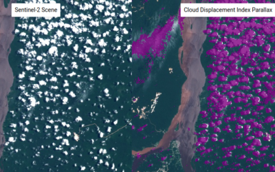
The spatial resolution, wide swath and revisit cycle, and open data policy of Sentinel-2 imagery provides the opportunity to monitor landscape changes effectively. However, the presence of cloud and their shadows inhibit monitoring efforts. Often useable data exists...
Review of Global Forest Loss Maps
In 2009, Indufor and Durham University began developing Guyana's forest monitoring system alongside the Guyana Forestry Commission. The outcome is an operational national monitoring system that reports deforestation at one-hectare scale. The forest change record spans...
Efficient Monitoring of Plantation Development and Change
New satellites are being launched monthly with most designed to record and monitor vegetation change. The increased temporal resolution (allowing daily revisit) represents an important shift towards continuous monitoring of resources. The ability to monitor the same...
Tracking Forest Loss in Cloudy Environments
One of the primary uses of satellite imagery for many applications is to monitor change across landscapes. Randomly scattered cloud across images is one an obvious nuisance that frustrates this process, and often analysts must resort to using manual interpretation and...


